Calculate distance between locations using latitude & longitude
This online tool allows you to calculate the straight-line distance, also known as "as the crow flies", between two locations using geographic coordinates.
This is useful if you're comparing distances between photos you've taken, planning a trip, or simply curious! The tool provides fast, accurate results using the Haversine formula, with the option to display the distance in either miles or kilometres.
Simply enter the latitude and longitude of both locations, select your preferred units, and click the Calculate button. The calculated distance will be displayed.
If you'd just like to see how this online distance calculation tool works, I have listed ten of my favourite UK seaside towns for you to experiment with. Simply click on the name of the town to populate the coordinates into Location One or Location Two fields, enabling you to calculate the distance between them.
We take your data privacy seriously. This free online distance calculator tool uses JavaScript to perform all calculations directly on your device. No data is sent over the internet or stored by us or a third-party.
Need help finding the latitude and longitude of your location?
Explaining what Latitude and longitude are
Latitude and longitude are numbers that help us find exact locations on Earth.
Latitude tells us how far north or south a place is from the equator, while longitude shows how far east or west it is from the Prime Meridian.
These numbers are given in degrees and are usually written with decimal points – for example, 51.50060 – and can be either positive or negative. The more decimal places included, the more accurate the location.
Latitude and longitude coordinates from online tools or maps are often shown with up to seven decimal places, giving precision down to about 1.1 centimetres. However, for most uses, four (11 metres) to six (0.11 metres) decimal places are usually accurate enough.
Use an online map tool like Google Maps
Visit Google Maps and search for the location that you're interested in.
Once the location appears on the map, right-click on the exact spot or address, and a pop-up window will appear displaying the exact latitude and longitude that you require.
You don't need to memorise them, simply click the coordinates highlighted in purple to copy them to your clipboard for easy use later.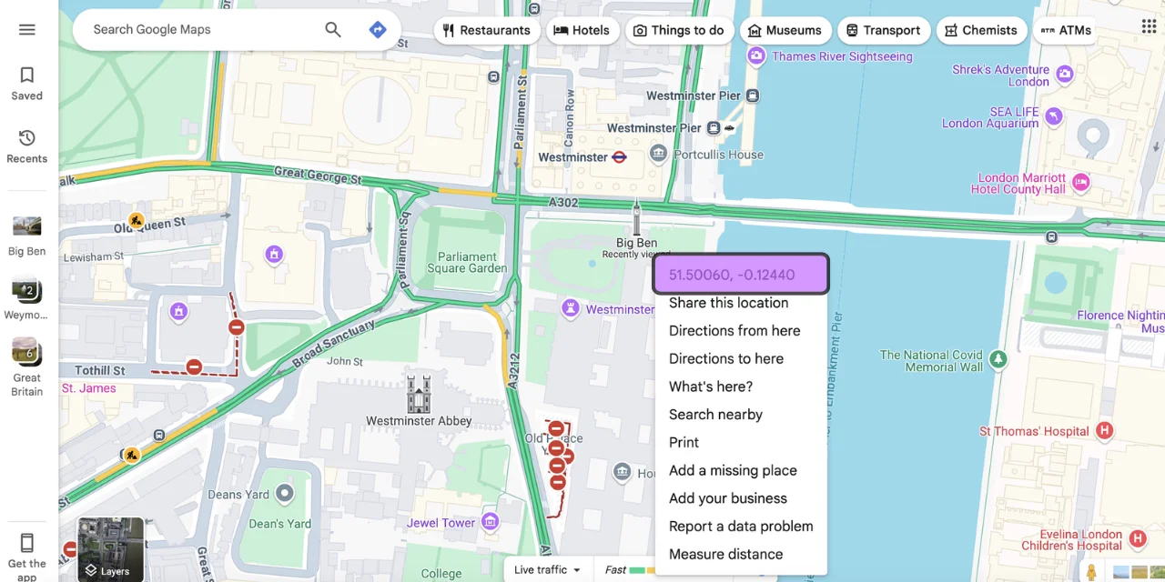
Use the metadata from a photo you've taken
Click on the Metadata Tool and upload the photo you want to extract coordinates from.
If your device stored location data, the latitude and longitude will appear alongside a host of other interesting metadata.
Again, there's no need to jot anything down, just click the Copy Coordinates button to copy them to your clipboard.